Canada’s Geography at a Glance
Canada is the second-largest country in the world by land area and one of the most geographically and climatically diverse nations. It stretches from the Atlantic Ocean in the east to the Pacific Ocean in the west, and northward to the Arctic Ocean. Its southern border with the United States is the longest undefended land border in the world.
Canada covers more than 9.9 million square kilometers, encompassing mountains, forests, lakes, rivers, islands, and Arctic regions.
🗺️ Political and Administrative Divisions
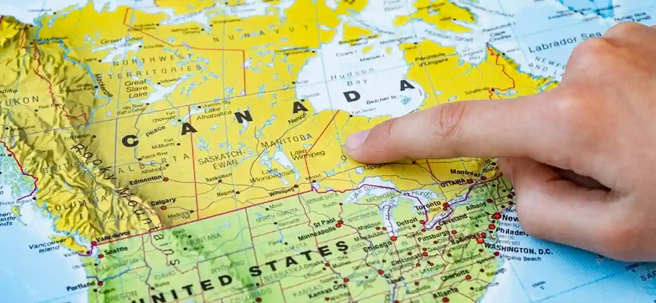
Canada is composed of 10 provinces and 3 territories. Provinces have greater constitutional powers and independent provincial governments, while territories are primarily administered by the federal government.
Provinces:
-
Ontario – The economic hub of Canada, with Toronto as its largest city. The federal capital, Ottawa, is also located in Ontario.
-
Quebec – The largest province by area, with a strong French-speaking cultural identity centered in Montreal; the provincial capital is Quebec City.
-
British Columbia – Located on the west coast, with Vancouver as a major port city; known for its mountainous terrain and rainy climate.
-
Alberta – Rich in oil and gas resources, with major cities such as Calgary and Edmonton.
-
Saskatchewan – The agricultural heartland of Canada, characterized by vast plains.
-
Manitoba – A key link between eastern and western Canada, with Winnipeg as its capital.
-
New Brunswick – A bilingual province (English and French) along the Atlantic coast.
-
Nova Scotia – A scenic peninsula with strong fishing and tourism industries.
-
Prince Edward Island – Canada’s smallest province, known for agriculture and the story of Anne of Green Gables.
-
Newfoundland and Labrador – Canada’s easternmost province, with a rich fishing heritage and maritime culture.
Territories:
-
Yukon – Famous for the Gold Rush and pristine northern landscapes.
-
Northwest Territories – Rich in natural resources and home to Great Bear Lake.
-
Nunavut – Canada’s newest territory (established in 1999), with a majority Inuit population and a unique Arctic culture.
🌎 Natural Features and Geographic Regions
Canada is divided into several major natural regions, each with distinct characteristics:
-
Atlantic Coast – Includes Newfoundland and Labrador, Nova Scotia, New Brunswick, and Prince Edward Island; known for rocky coastlines, fishing, and colonial history.
-
Prairie Plains – Includes Alberta, Saskatchewan, and Manitoba; fertile agricultural lands and major energy resources.
-
Canadian Shield – One of the oldest geological formations on Earth, with igneous rock and dense forests, covering large parts of Quebec, Ontario, and northern Manitoba.
-
Rocky Mountains – Stretch across British Columbia and Alberta and are part of UNESCO World Heritage natural sites.
-
Northern and Arctic Region – Includes Nunavut, Yukon, and the Northwest Territories, featuring glaciers, frozen landscapes, and the Aurora Borealis.
💧 Major Lakes and Rivers
Canada is often called the “Land of a Thousand Lakes,” although it actually has over two million lakes, more than any other country in the world.
Major Lakes:
-
Lake Superior – The largest freshwater lake in the world (shared with the United States).
-
Lake Huron
-
Lake Erie
-
Lake Ontario – Adjacent to the city of Toronto.
-
Great Slave Lake – Located in the Northwest Territories; Canada’s second-largest lake.
-
Lake Winnipeg – Located in Manitoba.
Major Rivers:
-
St. Lawrence River – A vital transportation route connecting Lake Ontario to the Atlantic Ocean.
-
Fraser River – In British Columbia, a major salmon fishing region.
-
Mackenzie River – Canada’s longest river (4,241 km).
-
Ottawa River – Forms part of the natural boundary between Ontario and Quebec.
🏔️ Natural Resources and the Environment
Canada is one of the world’s richest countries in terms of natural resources, including oil, natural gas, coal, nickel, uranium, timber, and freshwater.
-
Alberta, parts of Saskatchewan, and Newfoundland are major centers of oil and gas production.
-
British Columbia and Quebec have extensive forests that support much of Canada’s timber and paper exports.
-
Northern Ontario and Manitoba are significant for gold, silver, and nickel mining.
With approximately 20% of the world’s freshwater resources, Canada plays a vital role in environmental protection. Strict environmental policies, recycling programs, and clean energy sources—such as hydroelectric and wind power—are central pillars of Canada’s environmental strategy.
🌦️ Climate and Climatic Zones
Canada’s climate is highly diverse and can be broadly divided into several major zones:
West Coast Climate
Western regions, especially Vancouver and Vancouver Island, have a mild oceanic climate with rainy winters and cool, pleasant summers.
Continental Climate
Provinces such as Alberta, Saskatchewan, and Manitoba experience very cold, dry winters and short, warm summers.
Humid Continental Climate
Ontario and Quebec have warm summers and snowy winters, with four distinct seasons. Toronto and Montreal are prime examples.
Arctic and Subarctic Climate
Northern territories like Nunavut and Yukon experience long, dark winters and short, cool summers. The Northern Lights are commonly visible.
Atlantic Climate
Nova Scotia and New Brunswick have a climate similar to northern Europe—humid, rainy, with milder winters compared to central Canada.
🌍 Population and Geographic Distribution
Over 80% of Canada’s population lives within 200 kilometers of the U.S. border, mainly due to more favorable climate conditions and easier access to transportation and trade networks.
Major population centers include:
-
Southern Ontario: Toronto, Ottawa, Mississauga, Hamilton
-
Southern Quebec: Montreal, Laval, Quebec City
-
West Coast: Vancouver, Victoria, Richmond
-
Energy hubs: Calgary and Edmonton
In contrast, northern regions are sparsely populated and are primarily home to Indigenous Peoples.
⏰ Time Zones and Geographic Position
Canada spans six time zones:
-
Newfoundland Time (UTC −3:30)
-
Atlantic Time (UTC −4)
-
Eastern Time (UTC −5) — including Toronto and Ottawa
-
Central Time (UTC −6) — including Winnipeg
-
Mountain Time (UTC −7) — including Calgary and Edmonton
-
Pacific Time (UTC −8) — including Vancouver and Victoria
Due to the country’s vast size, when it is morning in Vancouver, it is already evening in St. John’s, Newfoundland.
🏞️ Iconic Natural Attractions
Canada is home to breathtaking natural landscapes, many recognized as UNESCO World Heritage Sites, including:
-
Banff National Park (Alberta) – The Rocky Mountains and emerald lakes.
-
Niagara Falls – On the Ontario–U.S. border; one of the world’s most famous waterfalls.
-
Jasper National Park – Known for wildlife and glaciers.
-
Georgian Bay Islands (Ontario) – A protected natural area.
-
Gros Morne National Park (Newfoundland) – Famous for unique geological formations.
-
Bay of Fundy – Between Nova Scotia and New Brunswick; home to the world’s highest tides.
-
Aurora Borealis in Yukon and Nunavut—one of the planet’s most spectacular natural phenomena.
📚 Summary
Canada’s geography reflects a remarkable blend of diversity, natural beauty, and harmony between people and nature.
From the snow-capped Rocky Mountains to the rainforests of British Columbia, from the vast Prairie plains to the Atlantic coastline, Canada is not only a place to live—but a source of inspiration and tranquility.
For a deeper understanding of each province and territory, it is recommended to consult the booklet “Newcomer’s Guide to Canada’s Provinces and Territories,” which provides comprehensive information on the geographic, cultural, and economic characteristics of each region.